Looking for a genuinely challenging hike in Northern California? Head to the Dome Trail in Butte County.
This strenuous, rewarding trail plunges to the Middle Fork of the Feather River, showcasing Butte County’s impressive granite formations and offering an adventure that is strictly for experienced hikers.
Dome Trail: Know Before You Go
Trail Difficulty: Difficult
Trail Length & Type: 4 miles, out-and-back
Added Challenge: Optional 1‑mile round-trip boulder scramble to Curtain Falls
Best Used: Accessible year-round, but best during summer, fall, and general dry spells. It can be unsafe for swimming in winter and spring due to cold waters and strong current. Avoid during strong storms, and access may be limited or blocked during low-elevation snow.
Dogs: Allowed on leash
More information: AllTrails
Butte County has big granite, and the Plumas National Forest maintains two trails that show off how Butte County rocks.
Big Bald Rock, a rock-hopping playground, is easily accessible from a short trail near Berry Creek and perfect for family adventures. Just a short distance away is Bald Rock Dome, which hovers over the Middle Fork of the Feather River and can be easily seen to the northeast from the Feather Falls trail.

The Challenge & The Granite Dome
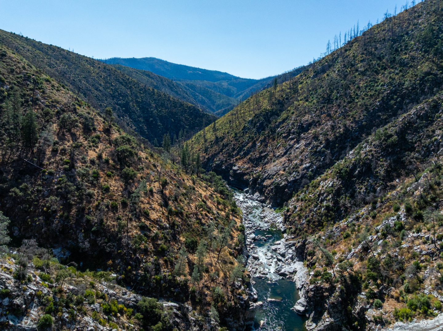
Dome Trail starts above Bald Rock Canyon and quickly shows off the best view of Bald Rock Dome, one of the northernmost granite domes in the Sierra Nevada Mountains.
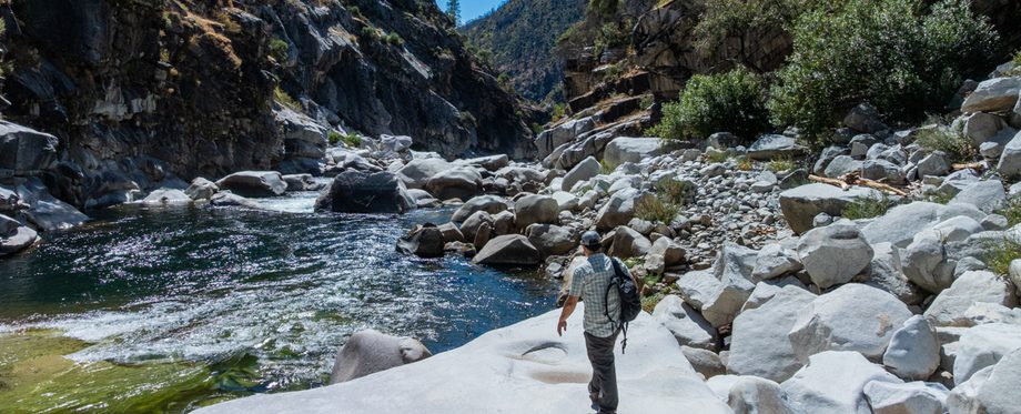
The trail plunges nearly 1,600 feet in a little over two miles to reach the Middle Fork just underneath the dome. After hiking through a burn-recovery area, a steady progression of switchbacks begins through pockets of trees and won’t let up until you’re deep within the canyon. This section of trail features an assortment of wildflowers during the spring and splashes of fall color in the autumn.
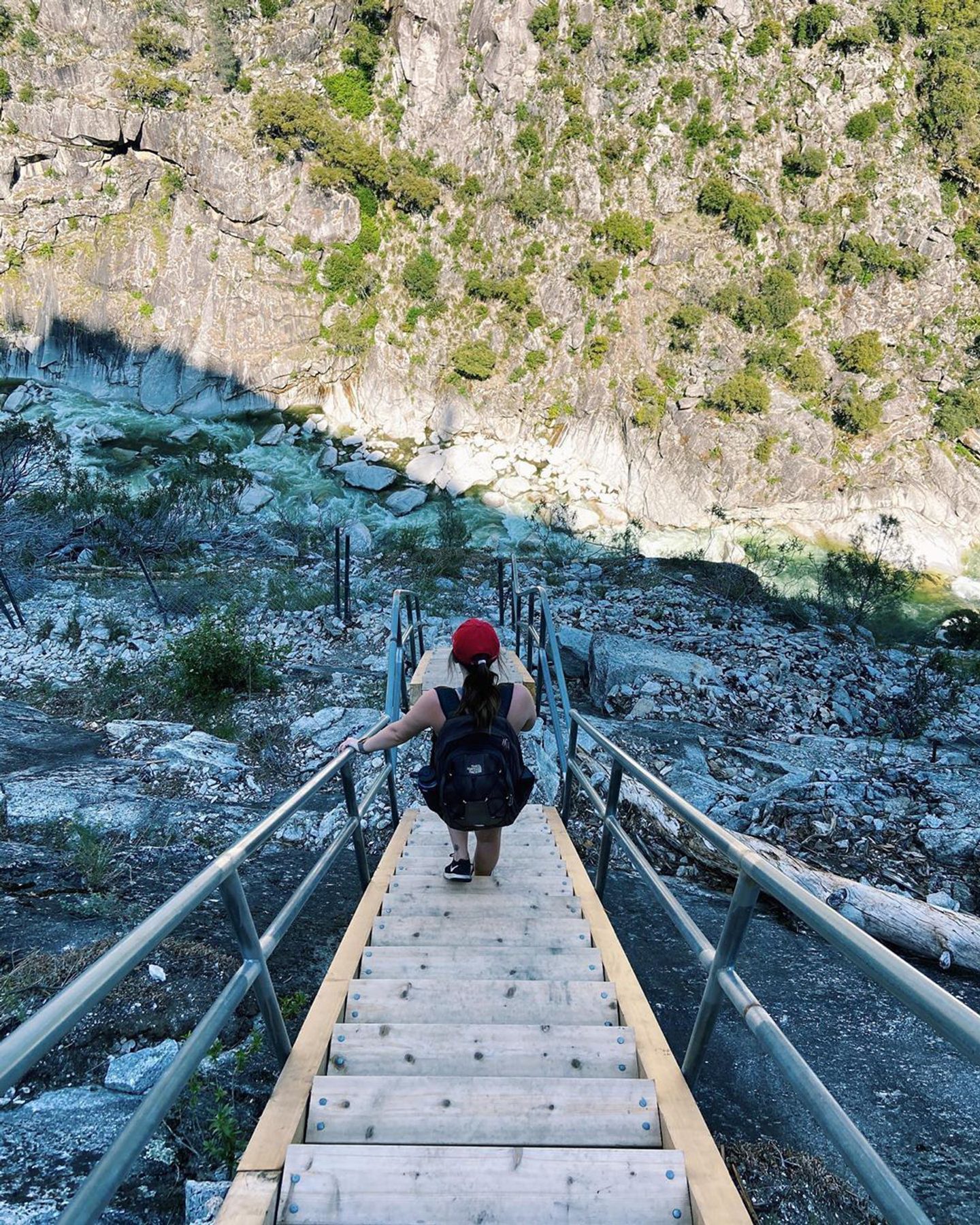
The last quarter-mile is mostly etched in stone, with one section squeezing you through a narrow rock crevice. The final approach to the river is made along a steep staircase.
Important: Although only four miles long round-trip (five if you include Curtain Falls), the return trip to the trailhead is strenuous, completely uphill, and can be exhausting in hot weather. Be sure to bring plenty of water for the climb back up.
The Payoff: Wild and Scenic River Access
Once you reach the Middle Fork of the Feather River, you’ll be standing in one of eight original stretches of river in the United States protected by the National Wild and Scenic Rivers Act of 1968.
Visitors during warmer weather can enjoy swimming in the many natural swimming holes. Adventurers looking for an added challenge and payoff can wade and boulder upstream for about 2,000 feet to find Curtain Falls, a 30-foot wide waterfall draped across a slab of granite that falls into a large swimming hole.
Directions
(Note — Google Maps may mislead you near the trailhead!)
- You can reach the city of Oroville by traveling south on Highway 99 from Chico. Follow the signs to Highway 149, then to Highway 70. If traveling from the south, take Highway 70 north from Sacramento or Marysville. In Oroville, take Exit 46 and head east on Highway 162 (Oro-Dam Boulevard) for 1.7 miles.
- Follow Highway 162 as it turns right onto Olive Highway. It will then turn into Oro-Quincy Highway and continue across the New Bidwell Bar bridge to the town of Berry Creek.
- After about 19 miles from Highway 70, turn left onto Bald Rock Road.
- Travel on Bald Rock Road for 8.5 miles and turn left onto Forest Road 21N35Y (this does not show up on Google Maps — the road that does show up to the south is private). Look for the sign that says “Dome Trail 3.”
- Continue for three miles along this slow-going dirt road until you reach the trailhead.
