
For an appreciation of scale, power, and history, few outings in Butte County are more fulfilling than a tour of the Oroville Dam.
Oroville Dam by the Numbers
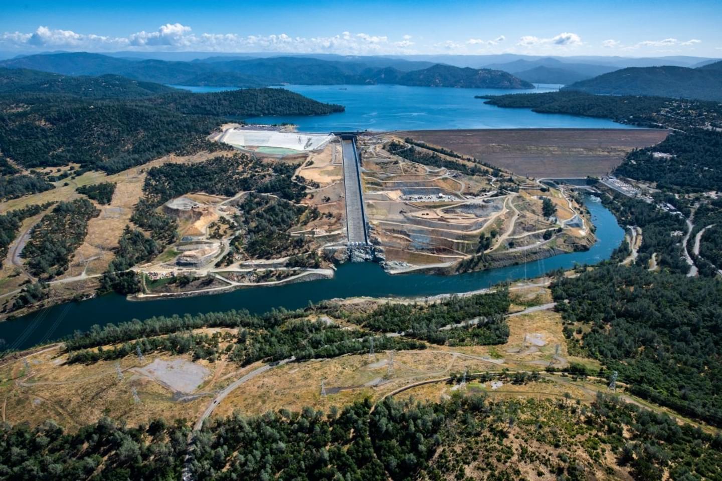
Oroville Dam has been the crown jewel of the State Water Project, and managed by California’s Department of Water Resources (DWR), since its completion in 1967. The eye-popping numbers alone might seem like enough to appreciate the sheer size of the structure: at 770 feet, it’s the tallest dam in the country and retains the contents of Lake Oroville—about 3.4 million acre feet — distributing the water to the entire Sacramento Valley.
The Dam’s Influence
But a visit to the dam — where no fewer than a half-dozen “wow” moments await visitors, especially those who choose to get a guided tour from DWR staff — is really needed to understand just how big the dam is. That’s the route I went on a cold January day earlier this year, and from the very beginning of the tour, it was clear to me how easy it is to take this behemoth for granted.
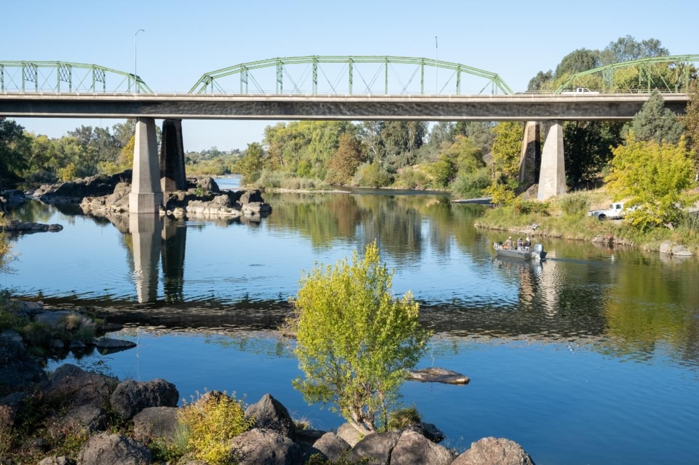
For more than 50 years, the Oroville Dam has developed and shaped the town’s history, and the two are inseparably linked — from the high-water marks located across town to the original green bridge that still stands, crossing over the Feather River on Montgomery. Our tour started here, looking at the bridge from underneath and taking note of the high-water marks and debris scuffings that characterize the bridges’ supports. From this vantage point, it was easy to imagine just how much water moved through this stretch during Northern California’s historical floods.
Power and Scale
When I took a moment to consider how much water the Oroville Dam is responsible for storing — a staggering 1.1 trillion gallons — I couldn’t help but marvel at how relatively infrequently those major flood events actually happen.
It’s because the dam is much more than simply “big.” Its history as a major source of employment during its construction is awe-inspiring when considering how the barrier (a mostly concrete core) was reinforced with man-made earthen support — an estimated 80 million cubic yards of earth, all originally filled one truckload at a time.
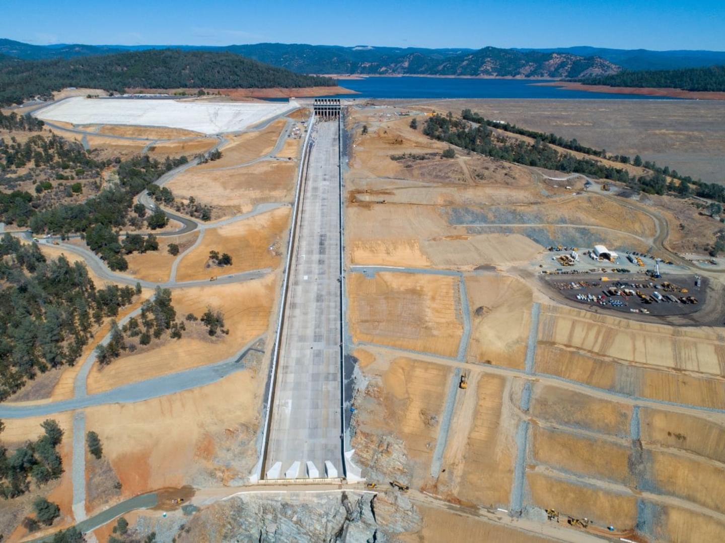
A winding drive up the dam’s mountainous ascent, above the spillway (and, exhilaratingly, past the spillway gates), is a humbling and awesome lesson in scale. You get a passenger’s‑seat view straight down the spillway. Even for someone with an appreciation for the structure’s immense size — longer than 1,000 yards — I stared in amazement at the sheer mass of concrete yawning down the side of the dam like a 12-lane superhighway. A little further up the road, what looks like a sprawling, concrete amphitheatre appears; this is actually a secondary emergency overflow area. Like just about everything else attached to the dam, it’s enormous.
Recreate at the Dam
I took all of this in while our guide, DWR’s Jana Frazier, displayed an encyclopedic knowledge of the dam. She gave us lessons ranging from agricultural to zoological and a dozen other topics in between, all related to the dam and its impact on the many interconnected systems relying on it. I truly appreciated the amount of context I was able to give what I was seeing, thanks to Frazier’s expertise.
Atop the dam, I had only one regret: I wished I’d brought a good camera and binoculars. The vantage point from 770 feet offers 360 degrees of viewing, and even as a brisk winter wind whipped around the parking lot and drive, it was easy to imagine a summer day in the same location. My mind started piecing together options for a visit — a picnic lunch at one of the rest areas atop the spillway; a bike ride or a hike down some of the easily accessible paths right off the launch ramp; a few moments spent admiring the vistas to the south or the hawks (or occasional eagles) gliding across the lake. But on this day, where no warm-blooded person would be seen on the water, Lake Oroville was a picture of serenity, a glass surface pierced only by the occasional jumping fish or waterfowl touching down.
What everyone knows about the Oroville Dam, of course, is that it’s immense. But my tour of it revealed more than just sheer size: It offers history, beauty, and a sense of appreciation for the dam’s role in the California ecosystem. To stand atop the dam and gaze over not just the wide expanse of Lake Oroville, but also the valley to which it’s so crucial, is an exercise in wonderment that shouldn’t be missed.
Interested in a Tour?
Contact the Department of Water Resources at (530) 534‑2306
