
Butte County is an amazing destination for things to do in Northern California’s Shasta Cascade region — from dining adventures to outdoor fun, it’s the perfect place for those looking to get away from it all without being away from it all.
But if you want to cast a wider net, our neighboring counties are just a quick and scenic drive away — you won’t have to drive more than an hour to get to most of them. You can wake up at your Butte County base camp, find yourself on top of a mountain or scenic lake by lunchtime, and be back before dinner! Oftentimes the drive itself is part of the adventure, too.
So get the most out of your Butte County adventure by crafting your perfect day-trip itinerary with these 30 diverse destinations within easy driving distances.
Colusa County
Colusa County borders Butte County in a countryside dominated by California wetlands, habitat, and rice fields. The City of Colusa rests along the Sacramento River and can be reached by a 30 minute drive from Gridley, making it a great stop when trekking to or from your Butte County base camp.
Colusa National Wildlife Refuge
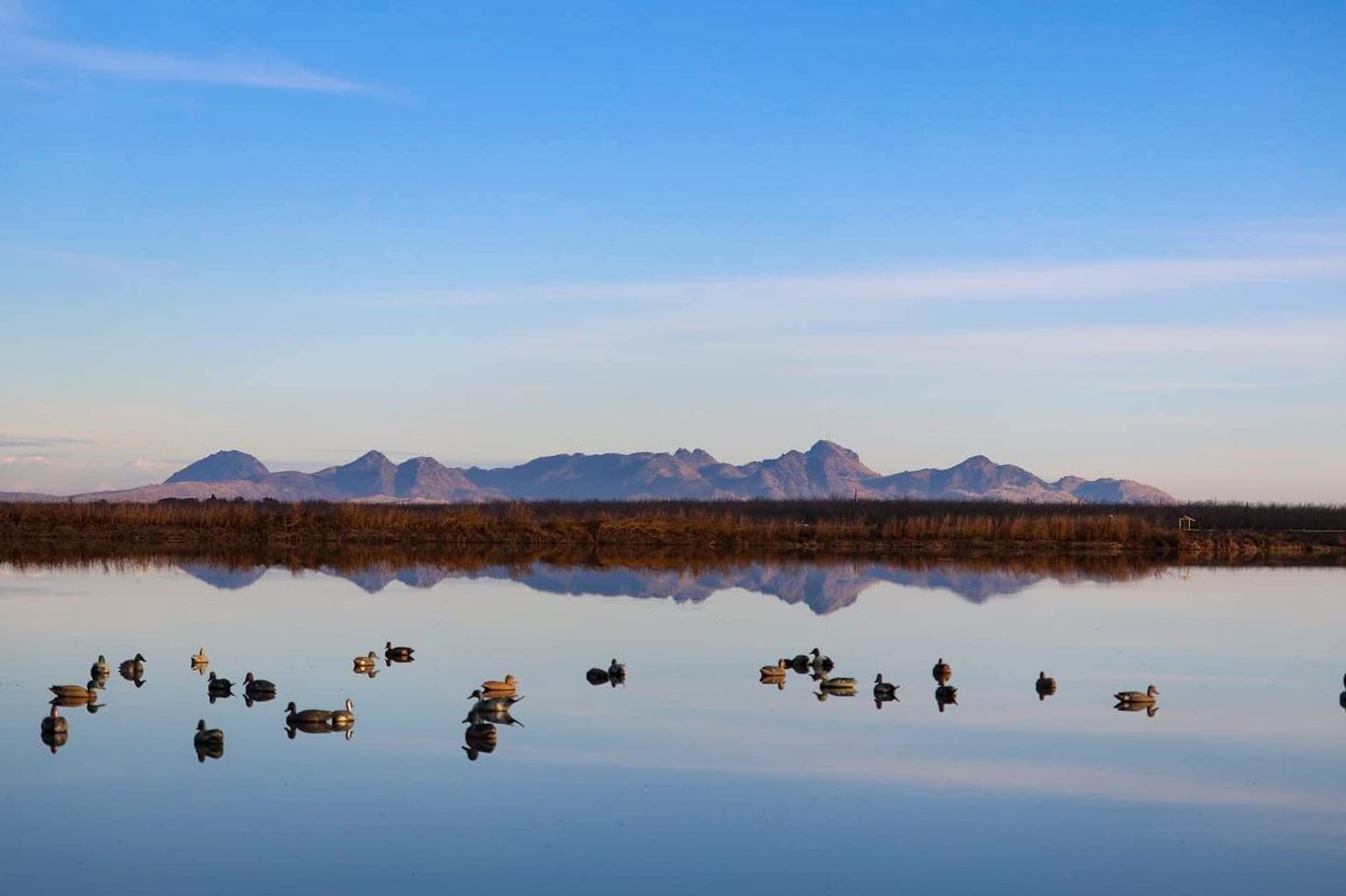
Further west is the Colusa National Wildlife Refuge just outside of the city of Colusa. Like many of the units in the Sacramento National Wildlife Refuge Complex, this unit includes a visitor center — where you can learn about Northern California’s beautiful environments — auto tours, trails, bicycling, photography, and hunting.
Distance from Butte County: 46 miles/54 minutes from Chico
Delevan National Wildlife Refuge
Delevan National Wildlife Refuge, similar to Butte County’s Grey Lodge Wildlife Area on the opposite side of the Sacramento River, is home to a large population of resident birds and migrating waterfowl. Bring your binoculars!
Distance from Butte County: 41.5 miles/47 minutes from Chico
Glenn County
The Sacramento River creates most of the border between Butte County and Glenn County. Like Colusa County to the south, Glenn County is split between the Sacramento Valley in the east and Northern Coast Range mountains and foothills to the west.
Orland, Glenn County’s largest city, is only about 20 minutes from Chico, one of Northern California’s best-known destinations.
The Orland Art Center
This cozy art gallery is home to local and visiting exhibits showcasing professional art from around the Northern Sacramento Valley and beyond. The Orland Art Center also hosts frequent seminars, workshops, and educational lectures.
Distance from Butte County: 20 miles/30 minutes from Chico
Sacramento National Wildlife Refuge
Road 68 from Interstate 5 to Princeton and then on to Highway 162 is a popular backroad into Butte County, and this route happens to take you through the largest of the Sacramento National Wildlife Refuge Units. Sacramento National Wildlife Refuge also has a large network of walking trails when they’re open between February 15 and June 30.
Distance from Butte County: 38 miles/44 minutes from Chico
Nevada County
Nevada County stretches from the lower Sierra Nevada foothills all the way to the State of Nevada beyond Truckee. Many of the adventures in western Nevada County, the area closest to your Butte County base camp, are accessible by taking short detours from Highway 20. The historic Grass Valley / Nevada City area is less than an hour’s drive from Oroville.
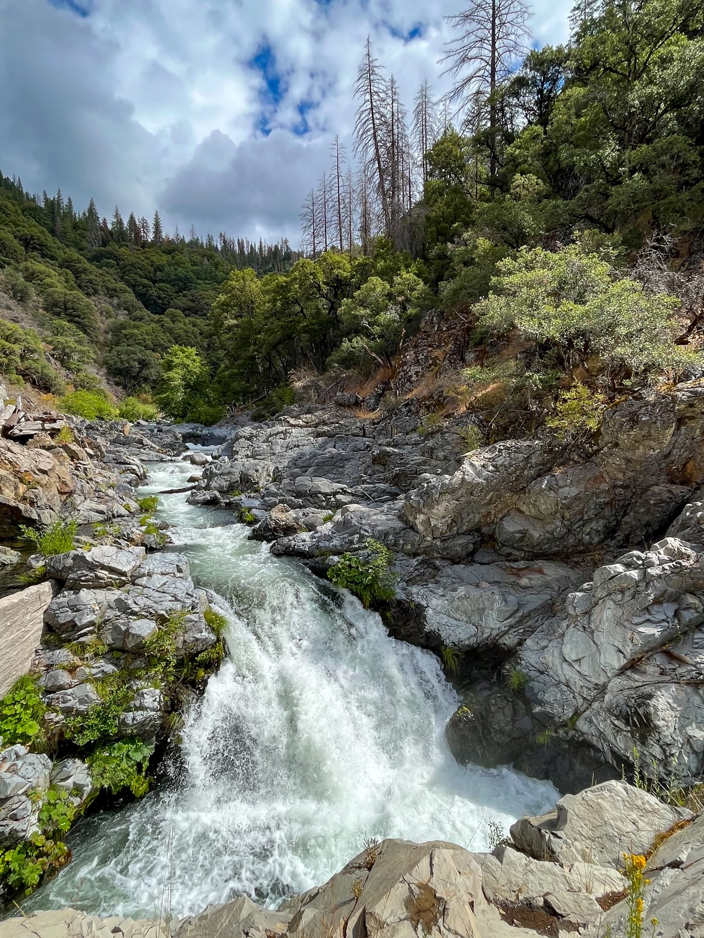
Beale Falls
Beale Falls, Fairy Falls, some even call it Shingle Falls — whatever you call it, this is a beautiful waterfall to visit when chasing waterfalls around Northern California’s gorgeous Sacramento Valley.
You can access Beale Falls by enjoying a 5 mile loop hike in the Spenceville Wildlife Area located just east of Beale Air Force Base. Being a State Wildlife Area, there are also birdwatching, hunting, and fishing opportunities aplenty.
Distance from Butte County: 50 miles/1 hour from Oroville
Empire Mine State Historic Park
Few places preserve California’s Gold Rush history like Empire Mine State Historic Park. Here you can stroll by mining equipment, working buildings, and lavish homesites either by yourself or on one of the park-led tours.
There are also several miles worth of hiking trails that lead into the forested foothill landscape near Grass Valley.
Distance from Butte County: 46.5 miles/53 minutes from Gridley
South Yuba River State Park
The South Fork of the Yuba River is packed with swimming opportunities, hiking trails, and gold rush history, and this State Park stretches along 20 miles of it. You can find the headquarters and a historic covered bridge at Bridgeport Crossing.
Distance from Butte County: 53 miles/1 hour from Oroville
Plumas County
Most mountain roads in Butte County eventually lead to Plumas County. “Plumas” means feathers in Spanish so it’s no wonder that many forks of the Feather River originate here. The communities of Chester and Quincy are just over an hour and half from the Paradise area, making them great stops on any Northern California trip.
Belden
The drive to the tiny town of Belden via California’s Highway 70 is an adventure all on its own. The Feather River Canyon starting near Oroville is one of the most scenic drives in the area and features double-decker bridges, tunnels, and frequent views of the North Fork of the Feather River.
Belden is also where the Pacific Crest Trail crosses Highway 70. Serious hikers can climb for miles and ascend several thousand feet on either side of the canyon. Those looking for a shorter walk can visit the Yellow Creek Trail, which starts at a historic stamp mill across the river from Belden.
Distance from Butte County: 50 miles/1 hour from Oroville
Bucks Lake
Here’s a California mountain lake that’s closer to the Oroville side of Butte County. Oro-Quincy Highway follows the historic Beckwourth Trail from Lake Oroville up to the Bucks Lake area.
The higher portions of this road closes during the winter season so this adventure is best done in the summer and fall. The Pacific Crest Trail also passes nearby at Bucks Summit with access to the Bucks Lake Wilderness.
Distance from Butte County: 49 miles/2 hours from Oroville
High Lakes OHV Area
High clearance vehicles only! Lassen National Forest’s High Lakes OHV Area includes a trail system with challenging terrain and beautiful high-country lakes. No off-trail travel permitted for vehicles.
This area is maintained by Friends of the High Lakes in partnership with Lassen National Forest and other user groups.
Distance from Butte County: Varies
La Porte / Little Grass Valley
The trip up La Porte Road begins near the Bangor Wine and Spirits Region and continues up into the mountains through Plumas National Forest.
Just past the small gold-rush town of La Porte, the Little Grass Valley Recreation Area offers yet another opportunity for outdoor fun in the Sierra Nevada Mountains. A 13 mile-long trail wraps around Little Grass Valley Reservoir connecting the multiple boat launches, beaches, and picnic areas.
Distance from Butte County: 49 miles/1.25 hours from Oroville
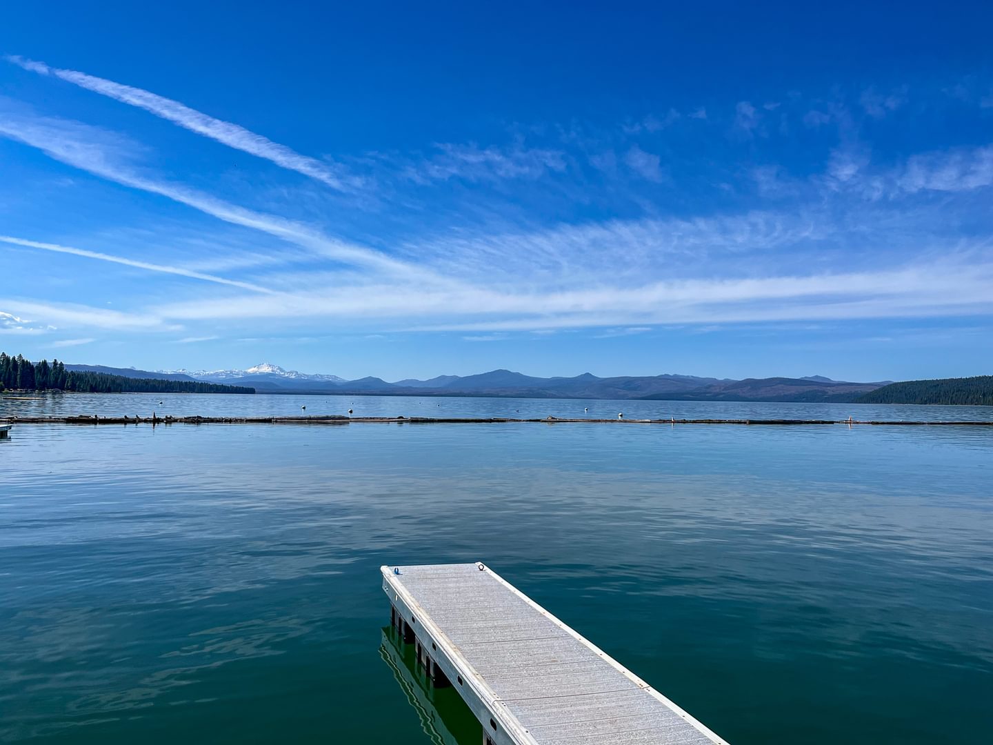
Lake Almanor
Lake Almanor is a popular day-trip for Butte County locals wanting to cool off a little while enjoying mountain scenery. Most of the shoreline of Lake Almanor is accessible from Chico in less than an hour and a half.
The western shore is home to multiple beaches, a nearly 10 mile-long bike path, and several picnic areas with views of Lassen Peak over the water. The trip from Oroville is slightly longer; however, you can pair it with the Feather River Canyon for one amazing drive!
Distance from Butte County: 69 miles/90 minutes from Chico
Sutter County
Northern California’s Sutter County sits across the Feather River from Yuba County and is best known for being the home of the Sutter Buttes and Yuba City, which are both only about 15 minutes away from Gridley.
Like South Butte County, Sutter County has expansive agricultural lands and habitat for migrating birds, making it a great place for birders of all stripes looking to set out from their Butte County base camp.
Sutter Buttes
Known to some as the World’s Smallest Mountain Range, the Sutter Buttes dominate the skyline in southern Butte County around Gridley. Road bikers can enjoy a 40 mile loop around the Sutter Buttes to see it from every angle.
Although the Sutter Buttes exist mostly on private property, Middle Mountain Interpretive Hikes leads a variety of guided adventures into this unique California volcanic range.
Distance from Butte County: 24 miles/41 minutes from Gridley
Sutter County Museum
The history of the Yuba-Sutter area has some overlap with Butte County — and the Sutter County Museum is a good place to learn all about it. Their collection contains over 20,000 artifacts and 8,000 photographs.
Distance from Butte County: 16 miles/21 minutes from Gridley
Sutter National Wildlife Refuge
The Sutter National Wildlife Refuge Complex includes several units in Butte County such as the Llano Seco Unit and Pine Creek Unit.
The southernmost of these is located in the Sutter Bypass, a flood basin between the Sacramento River and the Feather River.
Distance from Butte County: 22 miles/31 minutes from Gridley
Tehama County
Butte County’s neighbor to the north spreads from the Northern Coast Range mountains in the west to Lassen National Park in the east. The 40 minute drive between Red Bluff and Chico along Highway 99 is full of pastoral California landscapes and great views of Lassen Peak.
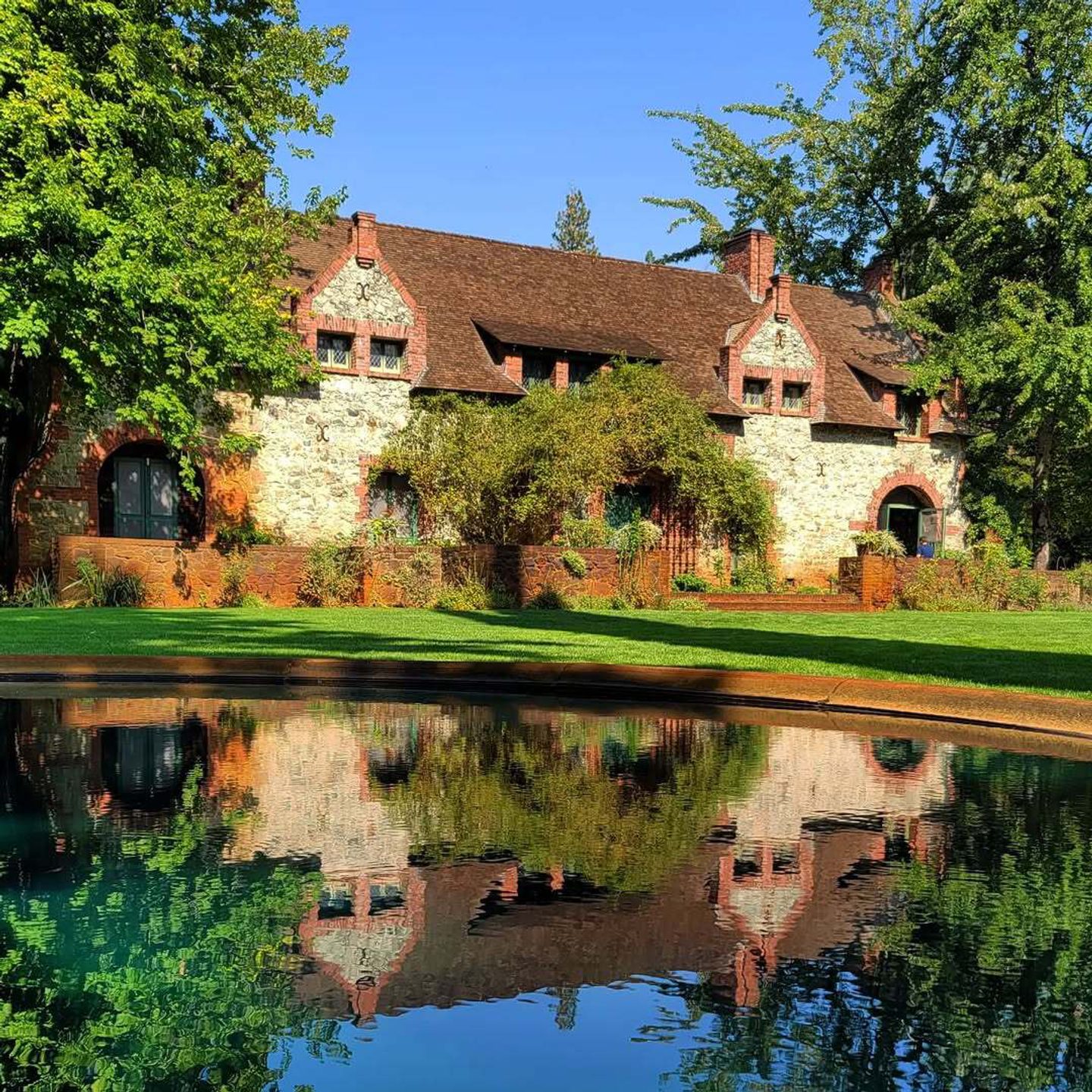
Abbey of New Clairvaux & New Clairvaux Vineyard
The small village of Vina is home to the Abbey of New Clairvaux where a community of Trappist monks make their home.
The grounds, which include a reconstructed Cistercian monastery and an award-winning vineyard, can be visited by scheduling a guided tour. This could make a great starting or ending point for a wine tour all around areas accessible from your Butte County base camp!
Distance from Butte County: 21 miles/26 minutes from Chico

Deer Creek Trail
Deer Creek Falls is most easily accessed off of Highway 32 halfway between Chico and Lassen Volcanic National Park — just 14 miles past the turn off to Butte Meadows. The Deer Creek Trail in Lassen National Forest meanders for over a mile along gentle but scenic forested terrain; you can also access it via a north or south trailhead.
Those that want to go further can continue on past a fish ladder at Lower Deer Creek Falls. Upper Deer Creek Falls is right off of Highway 32 just a few miles beyond the trailhead for the Deer Creek Trail.
Distance from Butte County: 42 miles/55 minutes from Chico
Dye Creek Preserve
Similar to Upper Bidwell Park in Chico, The Nature Conservancy’s Dye Creek Preserve has a rugged canyon landscape where the Northern Sacramento Valley and foothills meet.
The preserve is not open to the public generally, but you can sign up for guided hikes in the spring and fall to see this protected land.
Distance from Butte County: 36 miles/44 minutes from Chico
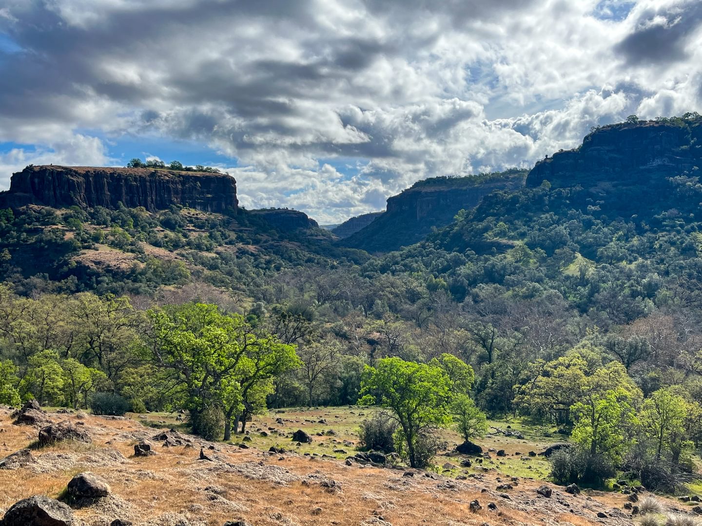
Ishi Wilderness
One of the most rugged and wild landscapes in all of California happens to be less than 20 miles away from Chico as the bird flies. The Ishi Wilderness, part of Lassen National Forest and the Lassen Foothills region, is separated from the rest of the state by deep canyons and tricky accessibility which allowed the Yana People to hide from California settlers into the 20th century.
This wilderness is named after Ishi, the last remaining Yahi individual who survived in the area before emerging from the foothills near Oroville. The Ishi Wilderness can be accessed from Ponderosa Way; however, a high clearance vehicle and a sense of adventure is mandatory.
Distance from Butte County: 47 miles/2.25 hours from Chico
Red Bluff Recreation Area
The Red Bluff Recreation Area sits alongside the Sacramento River and includes nature trails, disc-golf, picnic areas and the Sacramento River Discovery Center.
The boat launch here is the northernmost launch on the Sacramento River before encountering a diversion dam (there’s another launch just north of the diversion dam near downtown Red Bluff).
Distance from Butte County: 44 miles/54 minutes from Chico
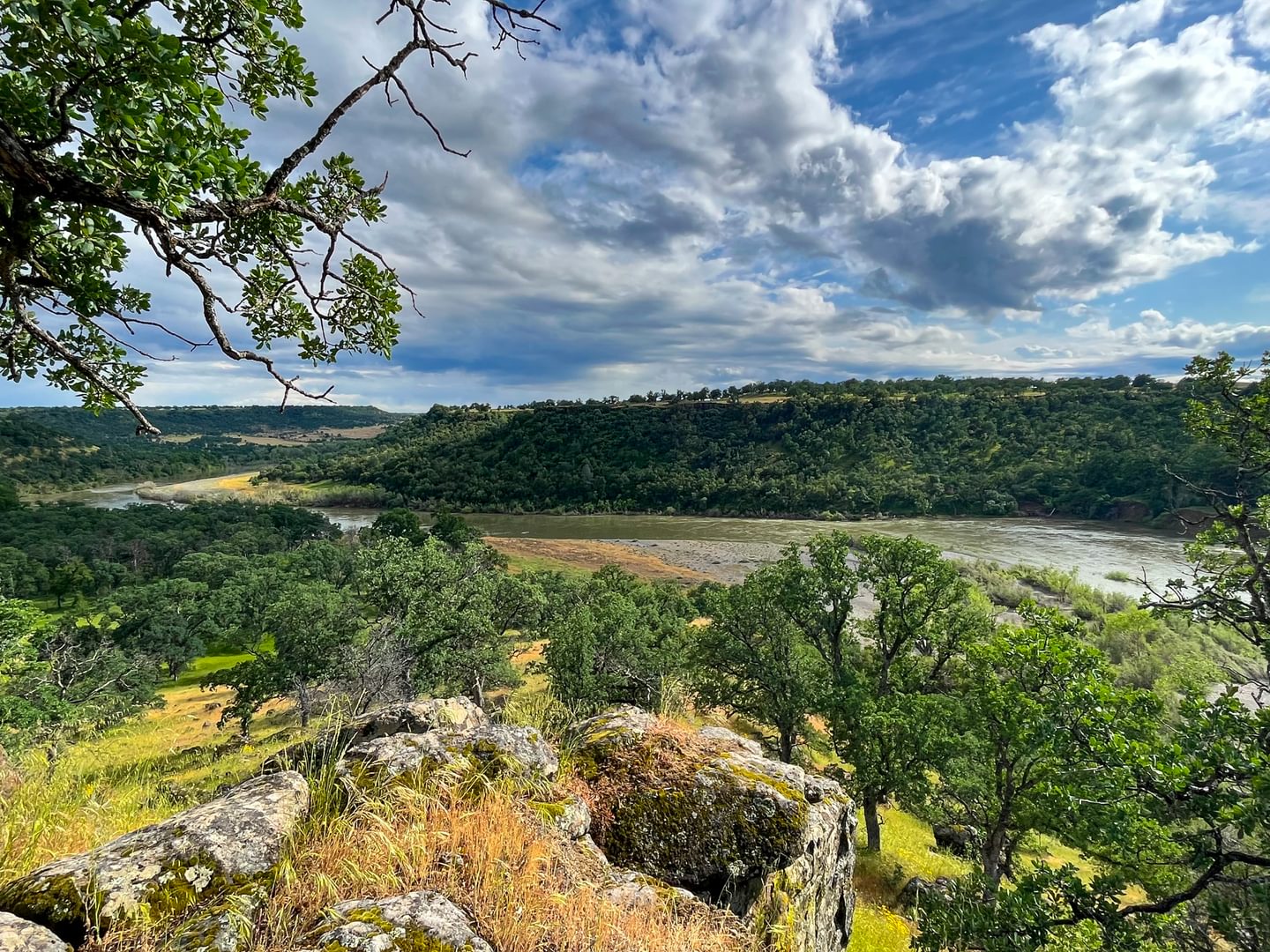
Sacramento River Bend Area
The Sacramento River Bend Area is a large area of oak-studded grasslands, wetlands, and riparian woodlands managed by the Bureau of Land Management. This is the only place to find the Sacramento River carving itself through scenic canyons downstream of Northern California gem Shasta Lake. It’s also a great area to go hiking, fishing, boating, and wildlife viewing.
The quickest hike to access coming from Butte County is the Iron Canyon Loop. Accessible from Highway 36, this adventure is a little under 4 miles round trip and is more enjoyable during the cooler seasons.
Distance from Butte County: 53 miles/1 hour from Chico
William B. Ide Adobe State Historic Park
This small historic park just north of Red Bluff showcases homestead life from the 1850s along the banks of the Sacramento River. The State Historic Park includes picnic areas, gardens, and short walking trails in addition to the exhibits and interpretive tours.
Distance from Butte County: 43 miles/50 minutes from Chico
Woodson Bridge State Recreation Area & Tehama County River Park
North of Butte County, the next opportunity to cross the Sacramento River by car is the Woodson Bridge on South Avenue. The Woodson Bridge State Recreation Area on the north side of the road is a compact but lush oak woodland that is open seasonally (April 1 — September 30) to camping and day-use.
On the south side of the bridge, Tehama County River Park is the next boat launch available on the Sacramento River north of Irvine Finch / Highway 32 (about 16 river miles away).
Distance from Butte County: 22 miles/26 minutes from Chico
Yuba County
Yuba County starts off in California’s central Sacramento Valley and rises into the Sierra Nevada foothills just southeast of Butte County. Oroville is 25 minutes north of Marysville and both cities are connected by Highway 70 and the Feather River.
Collins Lake
Collins Lake is 30 minutes southeast of Oroville and hosts an abundance of fishing, boating, picnicking, and camping opportunities. A hiking trail goes across the dam and follows the eastern shore for 2.5 miles.
Distance from Butte County: 23 miles/39 minutes from Oroville
New Bullards Bar Reservoir
New Bullards Bar Reservoir is less than 10 miles away from Lake Oroville as the bird flies but the rugged Sierra Nevada foothills between both lakes makes for an extended but beautiful drive. You can drive or walk across the dam itself with exciting sheer drop views.
New Bullards Bar Reservoir is operated by the Yuba Water Agency and is home to several boat marinas, 55 miles of shoreline, and 20 miles of trails.
Distance from Butte County: 53 miles/90 minutes from Oroville
Sycamore Ranch & Hammond Grove
These two Yuba County parks in Browns Valley sit side by side just north of the Yuba Goldfields. Sycamore Ranch has camping options in addition to day use pavilions and a boat launch into the Yuba River right where it empties into the Sacramento Valley. The Hammond Grove side has a riverfront beach along the Yuba River not far from a disc golf course.
Distance from Butte County: 33 miles/35 minutes from Oroville
Yuba Rim Trail
Located just downstream of New Bullards Bar Dam, the Yuba Rim Trail starts off of Marysville Road and descends to a forested overlook of the Yuba River. The trail to the overlook is 2.35 miles one way and descends about 750 feet.
If you want to extend your adventure and make it all the way to the Yuba River, you can follow the strenuous and unrelenting Yuba Drop Trail. These trails are part of Rice’s Crossing Preserve managed by the Bear Yuba Land Trust.
Distance from Butte County: 37 miles/54 minutes from Oroville
Multiple Counties
Sometimes, the best adventures extend beyond county lines. These destinations cross into multiple counties, showcasing the diverse beauty of the region. Get ready to explore wildlife refuges, sparkling lakes, and even a volcanic wonderland, all within easy reach of Butte County.
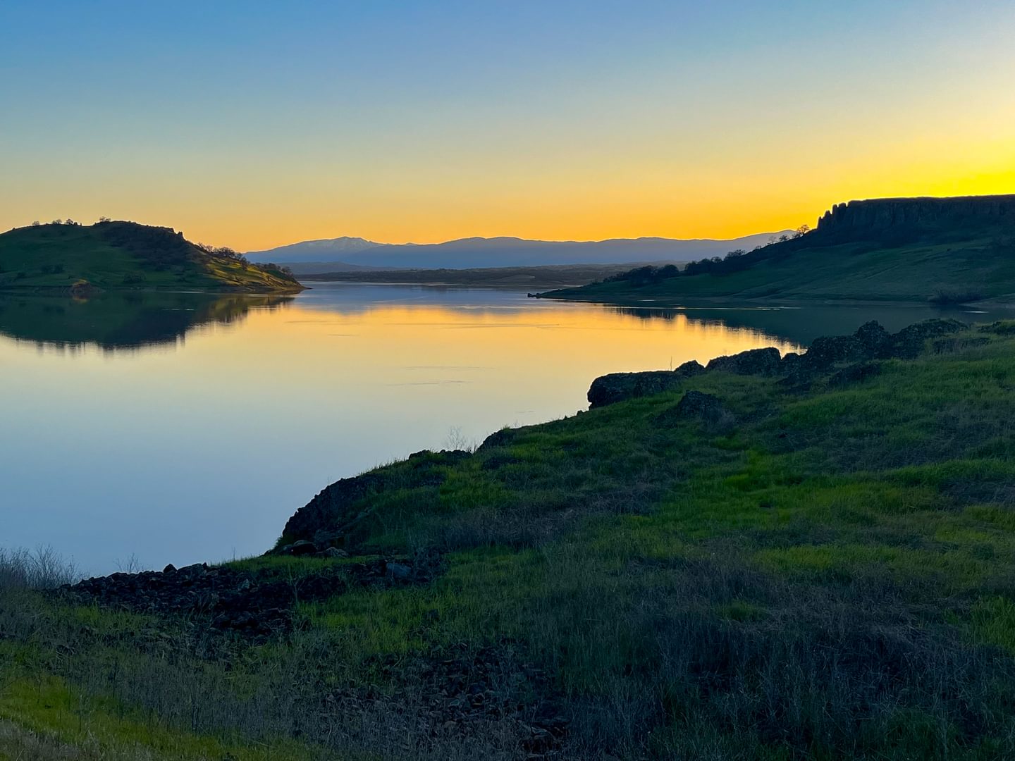
Black Butte Lake Recreation Area
Black Butte Lake, with 40 miles of shoreline when full, is another popular destination in the area for boating and fishing. There are two campgrounds operated by the Army Corps of Engineers as well as 20 miles of hiking and mountain bike trails.
The hike up to Black Butte from the dam is about 4 miles round trip and provides a wonderful view of California’s Sacramento Valley from the west side.
Distance from Butte County: 30 miles/44 minutes from Chico
Lassen Volcanic National Park
We’re definitely stretching the 30 mile criteria here, but it has to be mentioned that Lassen Volcanic National Park is an unmissable day trip from Butte County, with its Sulphur Works southwest entrance less than an hour and a half away from Chico.
Summer adventures include epic bucket-list destinations like Lassen Peak and Bumpass Hell, while winter offers amazing opportunities for snowshoers and backcountry skiers.
Distance from Butte County: 72 miles/97 minutes from Chico
Sacramento River National Wildlife Refuge
The land on the other side of Washout Beach (part of the Big Chico Creek Day Use Area in Bidwell-Sacramento State Park) is yours to explore as well! That side of the Sacramento River is part of the Capay Unit of the Sacramento River National Wildlife Refuge.
The Rio Vista Unit near the Woodson Bridge in Tehama County includes even more hiking trails alongside the Sacramento River.
Distance from Butte County: Varies; the Capay Unit is less than 15 miles/25 minutes from Chico