
The Brad Freeman Memorial Bike Trail in Oroville is so much more than just a “trail.”
It’s a tour of American railroad history and of California gold rush history; of the highest dam in the United States and the linchpin of the California State Water Project; of oak woodlands, riparian wildlife areas, and Sacramento Valley agriculture.
Above all, though, the Brad Freeman Trail is a 41-mile adventure around the Oroville area that offers a huge variety of scenic vistas and day trip options for hikers and mountain bikers. Equestrians can also use portions of the trail, especially around the Thermalito Afterbay and south of the Thermalito Diversion Pool. Although some may try to conquer large parts of the trail in one trip, most visitors will explore shorter segments of the trail. The trail itself is as varied as the scenery — with a combination of paved and unpaved surfaces, singletrack, levees, railbeds, and dirt roads.
Make sure to review hiking best practices and trail etiquette and follow Leave No Trace principles as you explore.
A Walk Across Oroville Dam
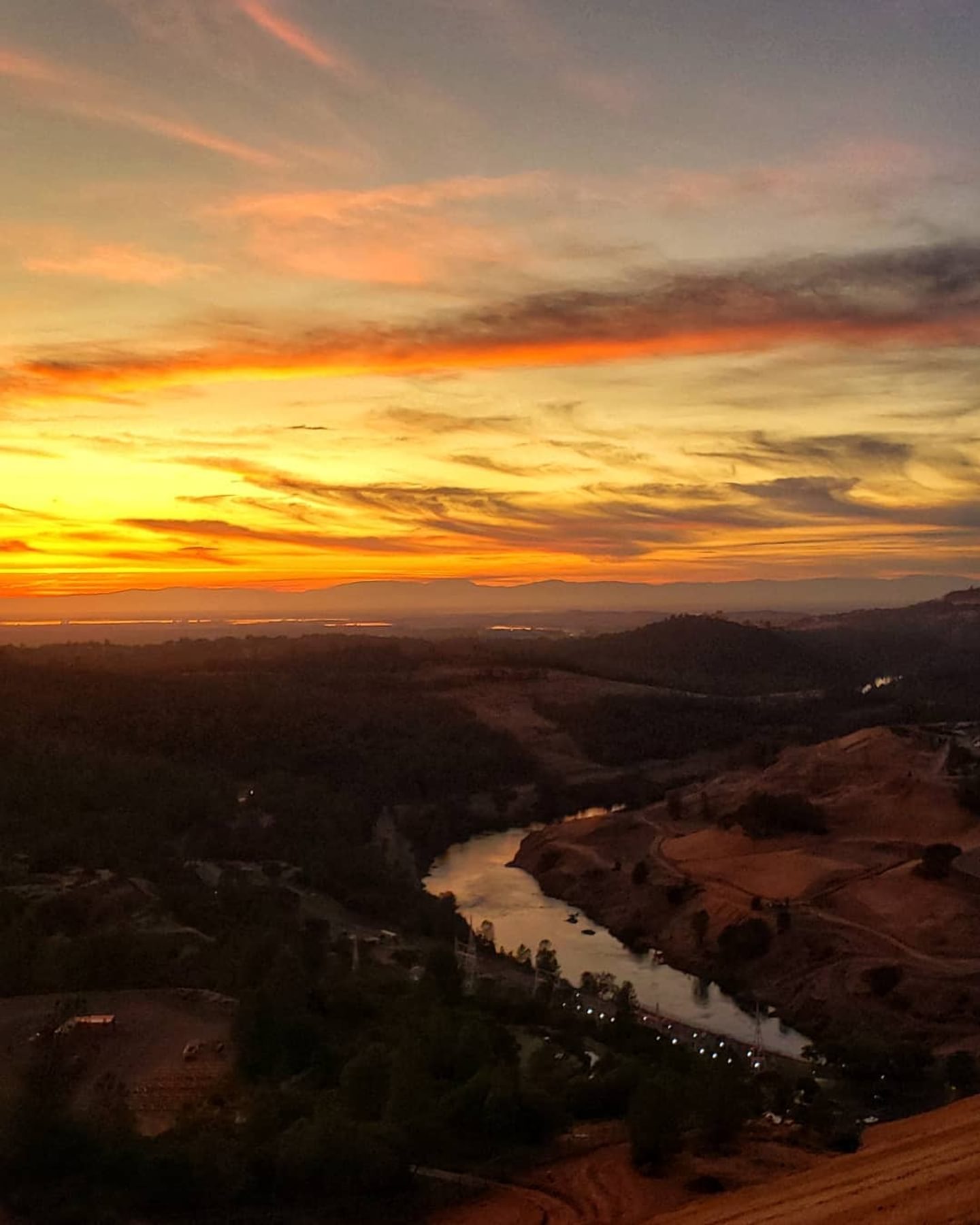
The highest point of the Brad Freeman Trail is atop Oroville Dam. This section is paved and is approximately one mile long between the upper dam overlook parking area (at the intersection of Canyon Oaks Drive and Royal Oaks Drive) and the spillway parking area. With Lake Oroville on one side and the Sacramento Valley on the other, the views are huge! Day use hours in the Lake Oroville State Recreation Area are generally 8am to sunset.
The Railway Tunnel
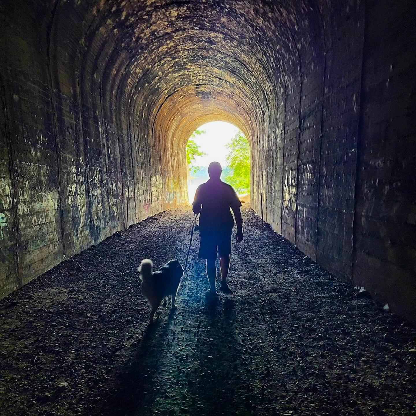
NOTE: As of Sept. 2025, the railway tunnel and the trails leading it are closed for repairs and updates. Check the interactive map for trail status information.
On the south side of the Thermalito Diversion Pool, the Brad Freeman Trail follows the path of the historic Feather River Route created by Western Pacific Railroad. You’ll be reminded of the origin of this section of trail by the train tunnel that you get to explore. The tunnel is one mile north of the Lakeland Boulevard parking area which connects to the Brad Freeman Trail via a short connecting trail. You can also access it by parking in the lot at the end of Old Ferry Road, just a few minutes past the Feather River Nature Center. From there, it’s a 1.15-mile walk until you reach the tunnel. (Map)
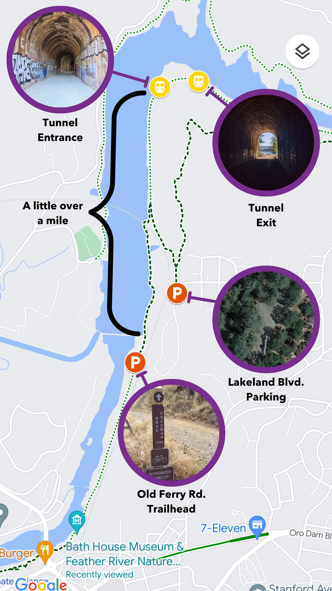
It’s about six miles to the Upper Dam Overlook parking area from Lakeland Boulevard, and there’s a big climb of about 600 feet on the final approach to the dam area. It’s along this stretch that you may have a front row seat to watch the Oroville Dam spillway in action. Hikers and equestrians have several loop options that include the Dan Beebe Trail which ascends Sycamore Hill for wonderful views.
Sights in the City of Oroville
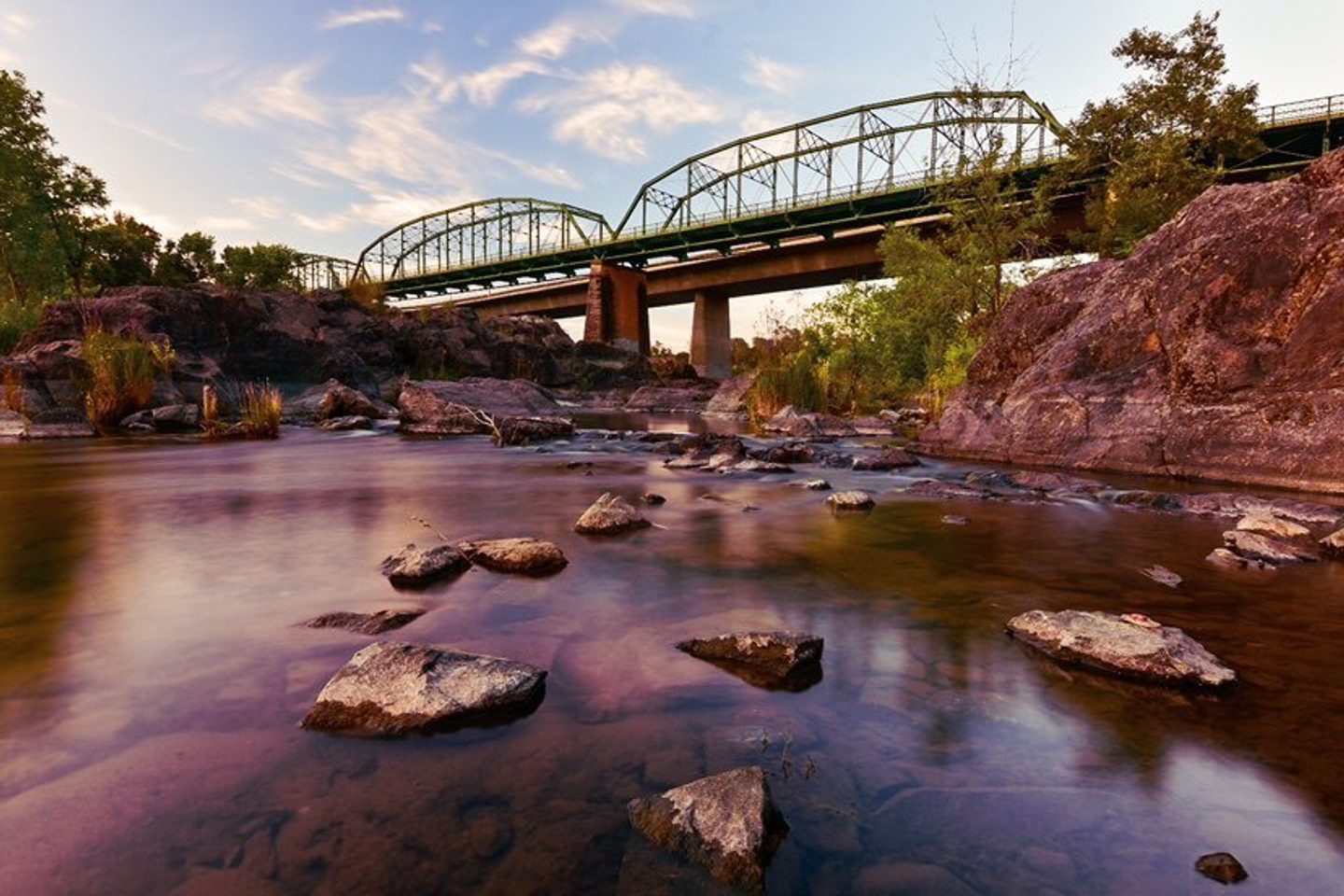
Just upstream of where Table Mountain Boulevard crosses the Feather River (on the eastern shore), the Brad Freeman Trail enters the City of Oroville and passes by the Feather River Nature Center, which is open daily from sunrise to sunset. The nearby Bathhouse Museum is open April through October on Saturdays and Sundays 12 – 4pm. This area is also just across the river from the Feather River Fish Hatchery and barrier dam, so you may see salmon jumping! Downstream of Table Mountain Boulevard and Washington Avenue, a two-mile section of the Brad Freeman Trail follows the Feather River through Bedrock Park and Riverbend Park. Downtown Oroville is within a short walk or ride as well.
Distance Tour of the Oroville Wildlife Area
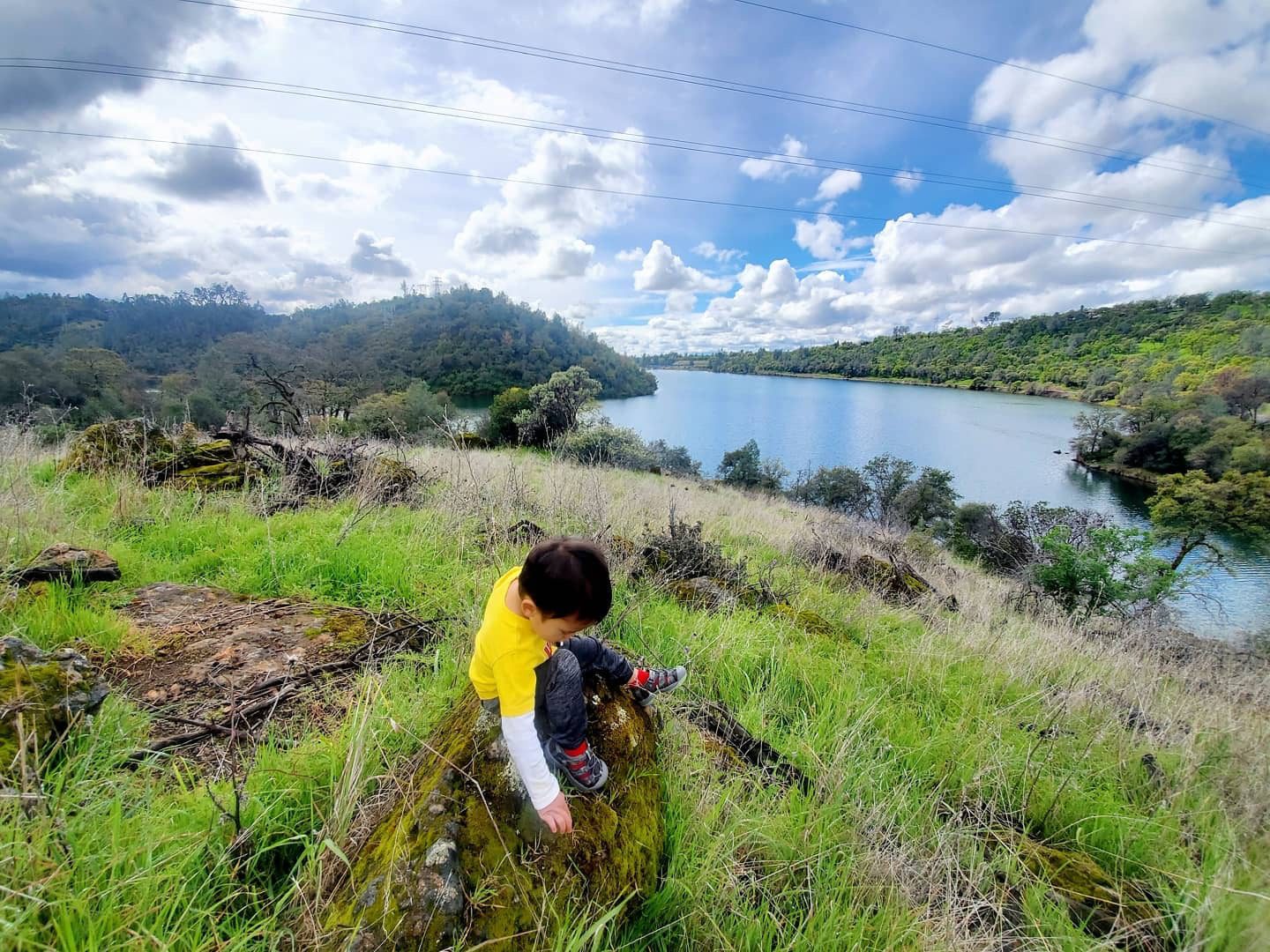
The Brad Freeman Trail alignment crosses the Feather River over Highway 162 and quickly heads south into the Oroville Wildlife Area. The next 16 miles are generally along dirt access roads (next to gold mining dredge tailings) and levee tops (around the Thermalito Afterbay). The abundant water along this route should surely treat you to a fair dose of wildlife encounters. There are trailhead access points for this section along East Hamilton Road, Toland Road, and Tres Vias Road.
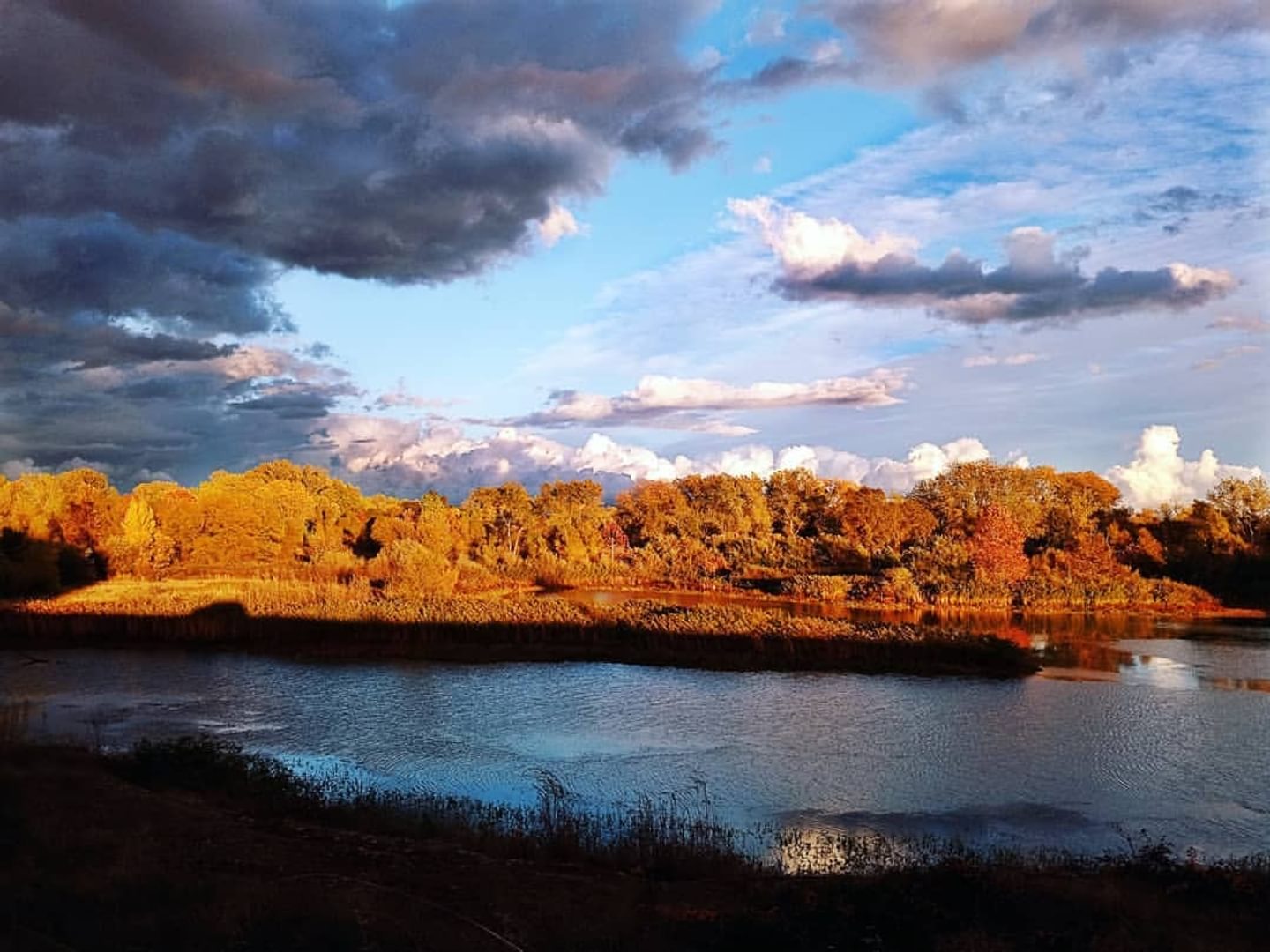
Around the Thermalito Forebay
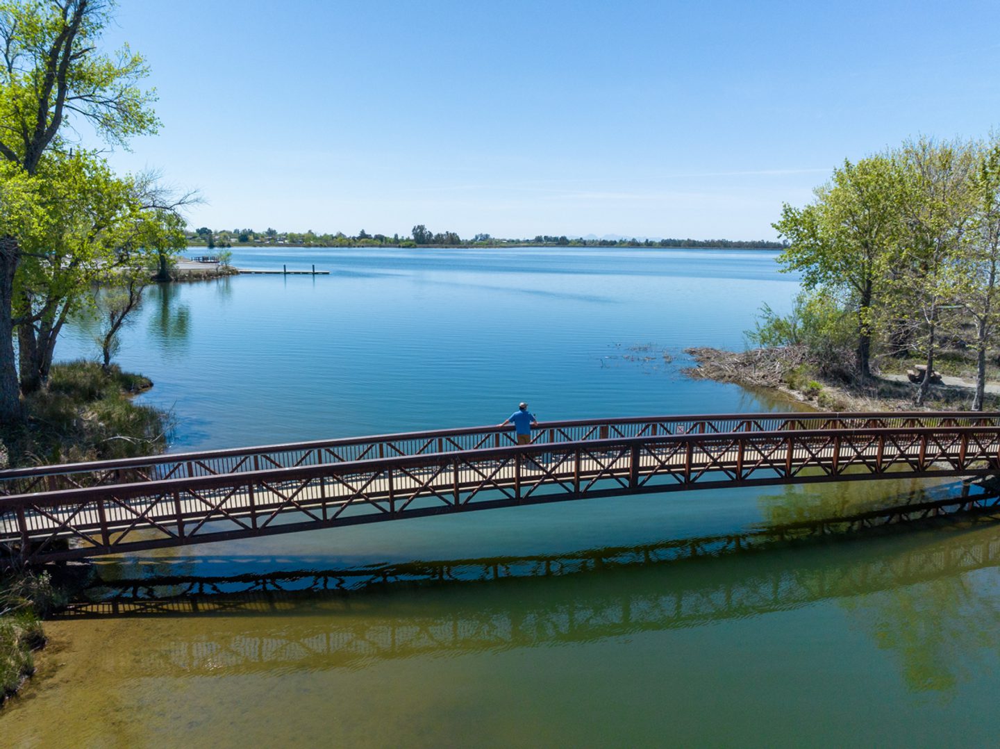
A three-mile section of the Brad Freeman Trail connects the South Thermalito Forebay picnic and boat launch area with the North Thermalito Forebay which includes the Forebay Aquatic Center. The portion of trail north of the Thermalito Forebay is especially scenic in the spring with lots of wildflowers! Each side of the Thermalito Forebay has restroom amenities and day-use parking. This section of the Brad Freeman Trail is open to mountain bikers and hikers.
North Side of the Thermalito Diversion Pool
The access for this wooded segment of the Brad Freeman Trail is off of Cherokee Road, 1.2 miles north of the intersection with Table Mountain Boulevard. The wide gravel trail (Burma Road) continues for about 3.5 miles back towards Oroville Dam with great views of the surrounding foothills. The trail has historically linked with the top of the Oroville Dam spillway area; however parts of the trail in this area may be closed periodically during work on the spillway.
Hike It
Featuring lake views, the North Thermalito Diversion Pool Section of the trail is a popular hiking, mountain biking, and kayaking spot — so feel free to enjoy the easy out-and-back hike and then try your hand at your own mini triathlon. Or just enjoy the hike. We won’t judge.
Modification: For another easy hike, check out the southern side of the Thermalito Diversion Pool section, which runs parallel to the Dan Beebe Trail and takes you through an old train tunnel.
Key Info
Trail Difficulty: Easy
Trail Length & Type: 6.4 miles out-and-back
Best Used: Accessible year-round
Dogs: Not allowed
Trail Map: AllTrails
Other Links: Interactive Oroville Recreation Map
Directions
From CA-70 take exit 48 for Nelson Ave. Take Cherokee Rd. to Brad Freeman Trail. Pass Thompson Flat Cemetery Rd. on your right. The road will begin to curve and you will pass Thompson Flat Rd. on your left. Soon after passing Thompson Flat Rd. look for a sharp turn on your right with a sign saying Lake Oroville State Recreation Area Thermalito Diversion Pool.
The road to turn off is unmarked but the sign is clear. Turn left once you reach the gravel road and drive all the way to the gate, or park on any of the turn offs along the way. (Note GPS might take you to Thompson Flat Cemetery Road, do not turn on this road, you are close, keep going straight on Cherokee Road and follow sign.)