With the Plumas and Lassen National Forests bordering the east, Bidwell Park running through Chico on the west, and Lake Oroville in the south, Butte County has miles of biking and hiking trails running throughout the region. So many, in fact, it’s nearly impossible to list them all — from easy to expert, urban to rural, there’s a trail for every activity and every skill level. You could spend a lifetime exploring them, and the locals definitely take advantage of their ability to do so!
If you’re visiting, though, you don’t have a lifetime to explore. Maybe you’re lucky to have a few days, or maybe it’s just an afternoon. Either way, you should know the best trails to experience while you’re in Butte County. So we reached out to a few of our local experts for their recommendations on trails worth traveling for.
Bike Trails Worth Traveling For
Butte County Biking Expert: Tim Olson, ex-Pro mountain bike racer and Butte County native
Trail #1: Guardian Trail
What Makes It Great?
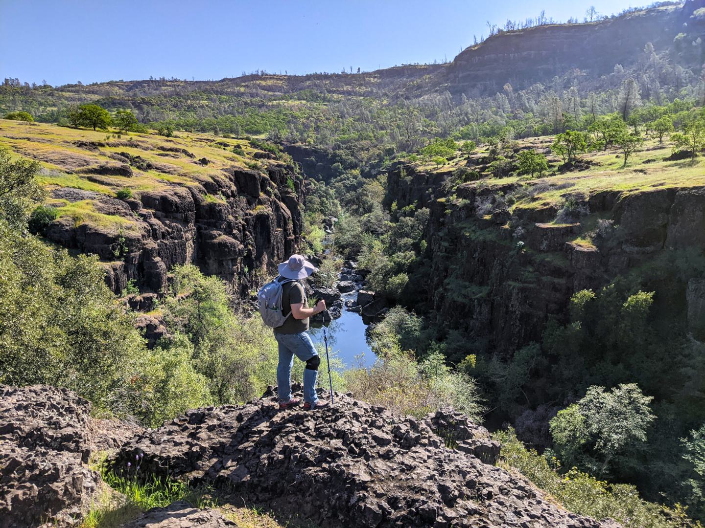
It’s about 5 miles of technical, rocky, twisty downhill that always leaves you satisfied at the bottom. If you want to take it slow, there are some caves and scenic overlooks along the way.
This is part of the downhill section of the annual Bidwell Bump race that has been going on for 40 years. I recommend this trail for experts unless you are willing to walk your bike on the tricky parts instead of riding it.
We’ve had some world class Enduro racers out here like Mark Weir, Marco Osborne and Kyle Warner, current national Enduro champ Amy Morrison, and they all have had a great time here.
Directions: Starting about 9 miles Northeast of Chico up Highway 32, you’ll see a green metal gate and a dirt parking area. Follow the dirt road about 1⁄4 mile downhill, then turn left on the trail and follow it all the way to Chico.
Trail #2: Feather Falls Trail
What Makes It Great?
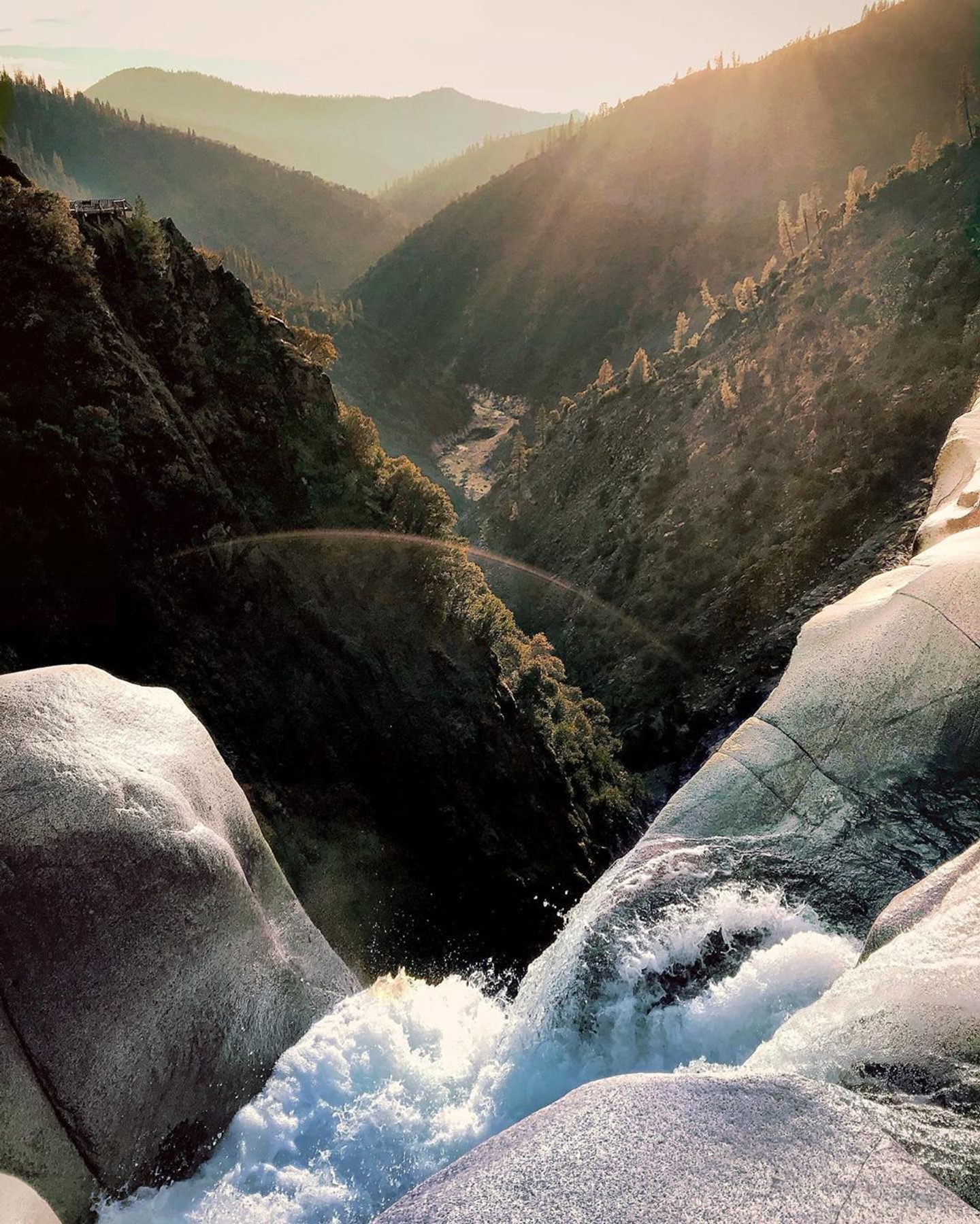
Feather Falls is amazing! Most people walk this trail, but if you can pedal the 2500’ elevation gain in the 9 mile round trip, it’s a great intermediate level ride. If you go on a weekday you’ll never see anyone out there.
I recommend the upper route both ways since the lower trail is overgrown and has suffered some rain damage, and is a much steeper climb on the return. On a busy weekend I would leave the bike at home and go on foot.
To hike this trail takes most people about 4 hours. To do it as a trail run or on a bike cuts it down to about 2 hours. You can’t ride all the way to the falls, but once you can hear the water just park it and you are basically there anyway.
Walk down the rocky steps to the overlook and enjoy. Don’t forget your camera. This is one of the largest falls in the United States and comparable to many of the falls in Yosemite.
Directions: From Oroville take Oro Dam Boulevard to 162 E to Forbestown road to Lumpkin road uphill to the trailhead. There’s a campground and signs everywhere so you can’t miss it.
Note: After North Complex Fire, the Feather Falls trail is very exposed to the elements. This is a strenuous hike, so please wear a hat and bring plenty of water.

Trail #3: Brad Freeman & Bidwell Canyon Trail
What Makes It Great?
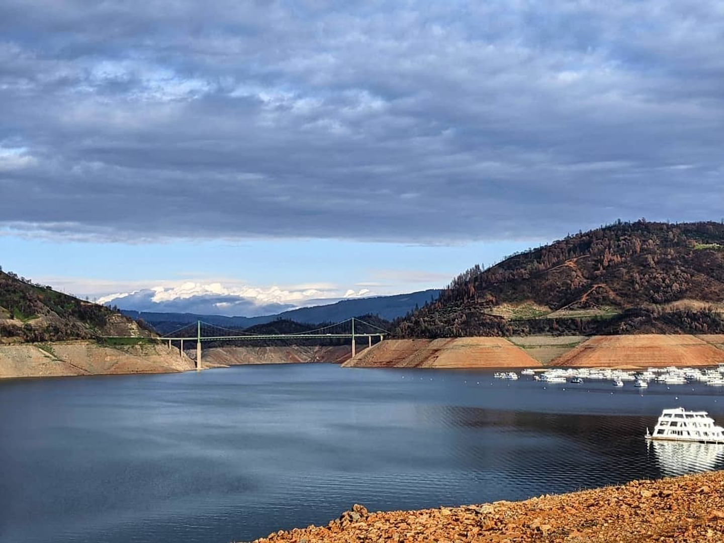
The Brad Freeman Trail, and specifically the Bidwell Canyon Trail portion, is a great beginner level mountain bike trail with spectacular views of the Oroville Dam spillway, Lake Oroville, old train tunnels, and the Lake Oroville Visitor Center. Minimal technical skill is required but you will be doing some climbing if you start at the bottom!
It’s just a really peaceful area, with relaxing trails and several spots to get water and take some nice breaks. I definitely recommend stepping inside the Lake Oroville Visitor Center if you have time. On a clear day you can see Mount Diablo in the distance from the observation deck.
Directions: Depending on your group you could start at the top and work your way down, or start in Downtown Oroville and go up and back. Starting in Oroville at the Table Mountain Boulevard bridge, head upstream along the south side of the Feather River toward the Nature Center trailhead access. You’ll see a dirt trail parallel to the railroad tracks. Before the railroad crosses a bridge, you cross the tracks and follow a flat trail along the river. Stay on this trail and follow the signs all the way to the top of the dam.
Once at the top, there are restrooms and a water fountain. Keep following the signs and map uphill all the way to the visitors center and the Saddle Dam trailhead access if you are up for it. Turn around and head back down.
Hiking Trails Worth Traveling For
Butte County Hiking Expert: Jason Mandly, Local Hiking Aficionado, trip organizer for the Chico-Oroville Outdoor Adventurers Meetup Group, creator of the California Hiking Map, and an air quality planner.
Trail #1: Feather Falls Scenic Trail
What Makes It Great?:
Feather Falls, pure and simple. It’s massive and the view from the overlook is one of the best in the northern Sierra Nevada range. The nine mile loop trail is a great workout too — with several stream crossings and views of the Wild and Scenic Middle Fork of the Feather River.
Directions: Get to Oroville via Highway 70. Take Highway 162 east for about eight miles and take a right turn onto Forbestown Road. After six miles turn left onto Lumpkin Road and continue into the foothills for another eleven miles. Turn left towards the Feather Falls trailhead when you see the trail signs.
Trail #2: Dome Trail
What Makes It Great?:
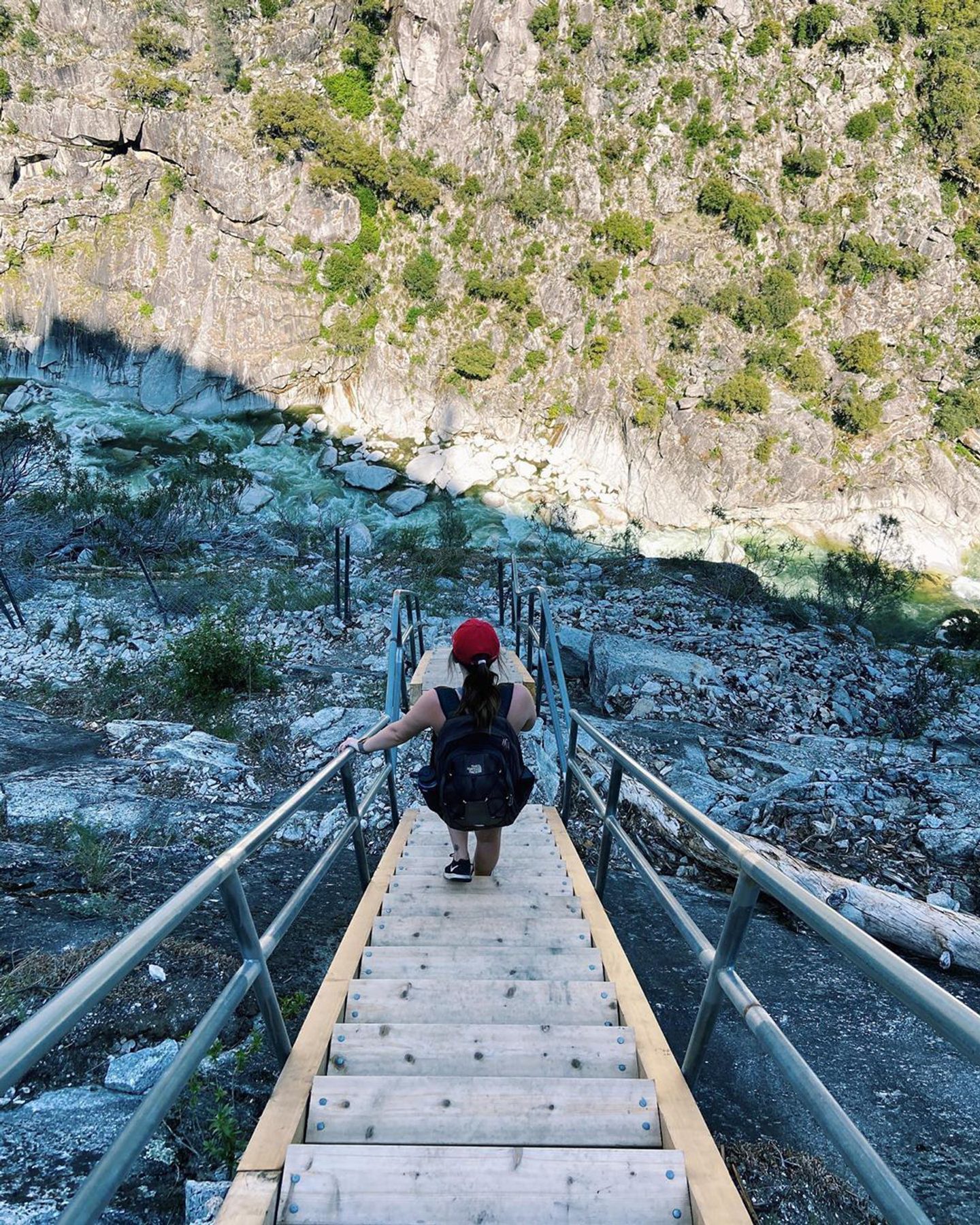
Amazing swimming holes and solitude. Did you see that rock dome while hiking to Feather Falls? Dome Trail takes you underneath Bald Rock Dome, through a rock fissure, and down a remote staircase to a Wild and Scenic stretch of the Feather River. It’s a tough adventure on its own, but you can pair it with nearby Big Bald Rock for double the granite!
Directions: Get to Oroville via Highway 70. Take Highway 162 east into the foothills for about 18 miles. Turn right onto Bald Rock Road and travel about 8.7 miles through the community of Berry Creek. Turn right onto Forest Service Road #21N51Y and continue about 3 miles on a dirt road to the trailhead.
Trail #3: Yahi Trail
What Makes It Great?:
Incredible beauty. There are so many trails in Upper Bidwell Park each with special perspectives and landscapes, but the Yahi Trail does a great job of showing off some of the park’s finest views. The Yahi Trail is great to visit any time of year too, with spring wildflowers, summer swimming holes, and fall foliage.
Directions: Get to Chico via Highway 99. Exit East Avenue and head east for about 2.5 miles. Continue through the traffic circle onto Upper Park Road. After about 1.5 miles you will see parking lots near Horseshoe Lake. After parking, walk east on Upper Park Road to find the beginning of the Yahi Trail.