
Adventuring and hiking in Northern California is abundant and beautiful — and Butte County is no exception, especially if you’re looking for options that are more easily accessed. From the trails running throughout Chico’s Bidwell Park to waterfall-studded ones in Oroville to higher elevation snowy adventures, you’ll find some of the best hiking trails and adventure spots in the North State.
Our list of the top 15 adventure and hiking spots in Butte County is a great place to start your explorations.
Make sure to review hiking best practices and trail etiquette and follow Leave No Trace principles as you explore.
Feather Falls Scenic Trail
With fans voting the Feather Falls Scenic Trail the favorite Butte County outdoor spot, they declared that it really is all about the journey over the destination. Leading to the beautiful (and third-favorite spot) Feather Falls, the trail is a stunning and challenging 7‑to‑9 mile hike through the Plumas National Forest.
Whether you choose the shorter and more challenging or longer yet easier trail, you’ll enjoy incredible views of Bald Rock Dome, Bald Rock Canyon, and Feather Falls (both on the way in and up-close) as you walk through the canopied forest.
Note: After North Complex Fire, the Feather Falls trail is very exposed to the elements. This is a strenuous hike, so please wear a hat and bring plenty of water.
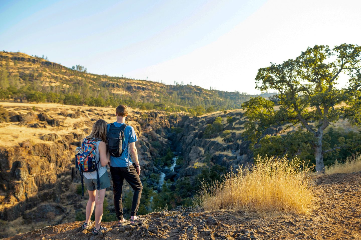
Yahi Trail
The most popular trail in Chico’s Bidwell Park, the pedestrian-only Yahi Trail follows Big Chico Creek with plenty of shade and a stunning spring wildflower display. Though the trail is 8.8 miles out-and-back, there are plenty of entry points along the way, many with parking lots nearby, making the Yahi an ideal trail for all skill levels. In the summer, you’ll especially enjoy stopping for a dip in one of the many natural swimming holes along the way.
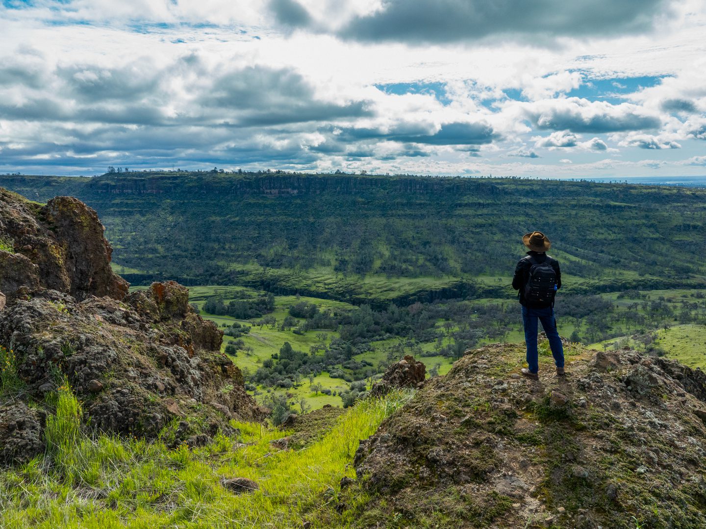
Many Waterfalls Cross-Country Loop
A springtime favorite, the Many Waterfalls Cross-Country Loop on the North Table Mountain Ecological Reserve earns its name during the wet season, when at least nine, and up to 14 waterfalls, start flowing after a rainfall. The challenging hike is well worth getting a little wet and muddy for. In late winter and early spring, you’ll definitely want to track any storms coming through the area and make sure to hike it right afterwards to see the most waterfalls.

Big Chico Creek Ecological Reserve
Comprising nearly 4,000 acres of diverse canyon and ridge habitats, including 4.5 miles of its namesake, the Big Chico Creek Ecological Reserve is an educational resource for Chico State as well as a beautiful location to enjoy nature viewing. Open from dawn to dusk daily, celebrate the diversity of flora and fauna found in the reserve with a nature hike.
North Rim Trail
One of the longest trails in Upper Bidwell Park, North Rim Trail is popular with both hikers and bikers for its sweeping views of the park offered from the lookout point at its end. The gradual grade and well-established trail make the trail fairly easy, though you can jump onto adjacent trails to increase your challenge and see even more of the park.
Lower Bidwell Park
More accessible than its Upper Park counterpart, Lower Bidwell Park is flat and level, with paved paths, making it the perfect spot for easy, family-friendly, and wheelchair accessible strolls and bike rides. Roughly 6 miles roundtrip and mostly covered with a thick canopy of trees, the loop around Lower Park is a leisurely one.
Butte Creek Ecological Preserve
The Butte Creek Ecological Preserve is a beautiful 93-acre site along the middle section of Butte Creek. It’s home to many species of special status, making for extra-special hikes through the Butte Creek watershed area.
Guardian Trail
Especially popular with cyclists but great for hikers as well, the exposed single track that is the Guardian Trail offers sweeping views of the Chico Creek Canyon below and the valley to the west. All downhill with some extreme drop-offs along the trail edges, it’s a difficult and rewarding ride.
Annie Bidwell Trail
On the Annie Bidwell Trail, you’ll find beautiful views of Big Chico Creek with fewer crowds than those found on some other trails in Bidwell Park—which is great for those who do make it out there. They’ll get to enjoy fewer people as they take in equally great vistas, especially the spring wildflowers and fall color changes.

Dome Trail
Perhaps the most difficult hike in all of Butte County, Dome Trail is a must for experienced hikers and adventurers. You’ll plunge nearly 1,600 feet over two miles, squeeze through a narrow rock crevice, and traverse a steep staircase to the Middle Fork of the Feather River. You’ll be awarded with views of Big Bald Rock along the way and natural swimming holes at the river. Just remember — you have the exhausting return (all uphill) trip.

Pacific Crest Trail Through Butte County
The Pacific Crest Trail (PCT) is a long-distance hiking trail traveling from Mexico to Canada. Butte County shares a 12 mile stretch of the PCT (with Plumas County) near the halfway point. The six mile hike between Humboldt Summit and Humbug Summit features amazing views of the surrounding mountains, including Lassen Peak, and offers a chance to visit Butte County’s high point (at 7,124 feet).

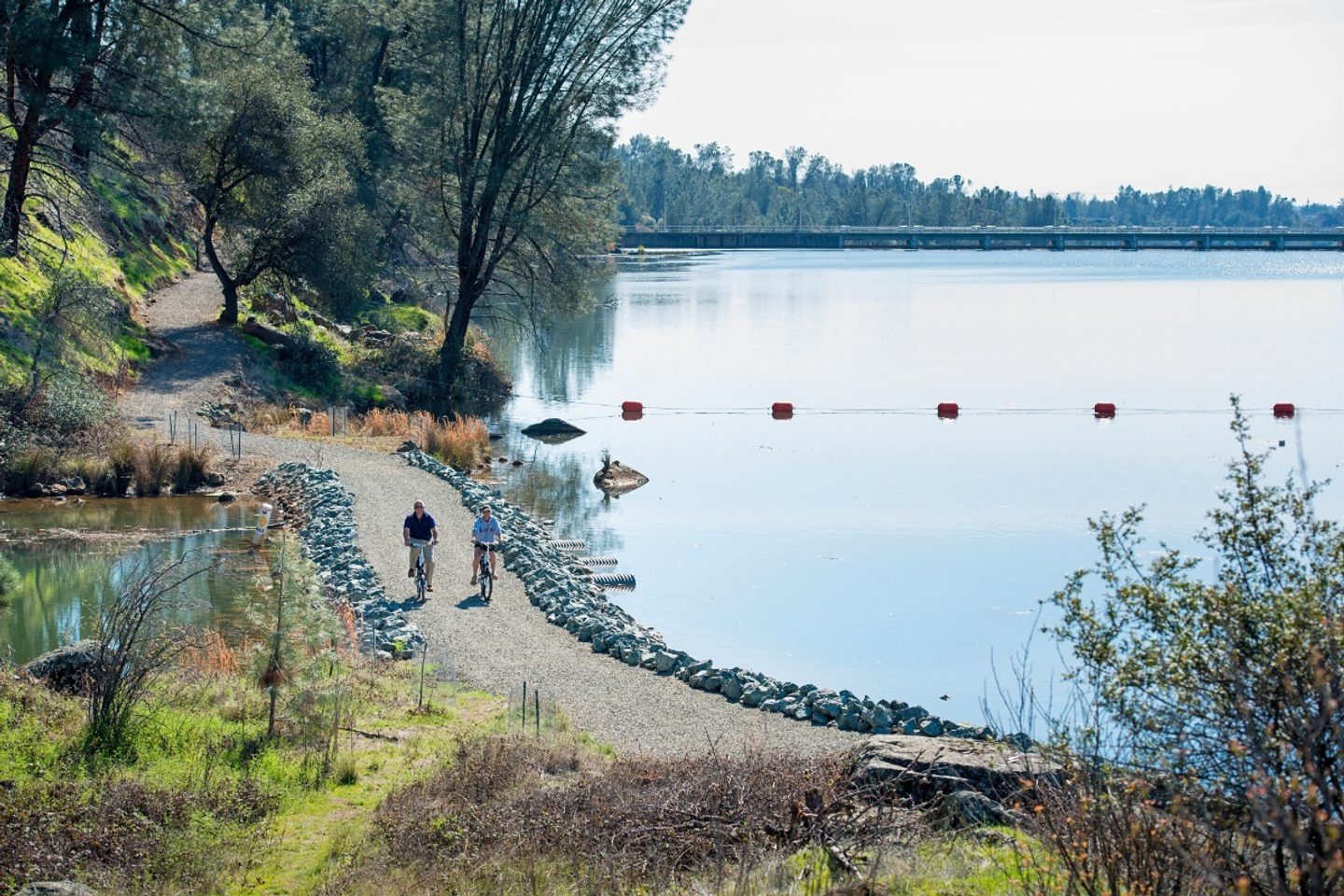
Brad Freeman Trail
History buffs may find the Brad Freeman Trail in Oroville particularly interesting, as it provides a tour of American railroad history, of California gold rush history, and of the Oroville Dam. But you don’t have to have much interest in the history around the trail to appreciate the 41-mile adventure that offers a variety of scenic vistas and day trip options. It’s one of the best ways to experience Oroville and all that it has to offer.
Snowmobiling in Jonesville
During the winter, the high country along the northeastern border of Butte County turns into one of its few spots for snowy adventures, with snowmobiling in Jonesville a particularly popular choice. The snowmobile park located at the Jonesville Staging Area provides over 60 miles of groomed trails, with several loop options. From there, you can access Colby Mountain Lookout for views of Lassen Peak or even ride all the way to Lake Almanor for a full day of adventure.
Humboldt Peak
Located along the highest ridge in Butte County, the hike to Humboldt Peak is a short but rewarding one, taking you to the (almost) highest point in the county at 7,087 feet. To get there, you’ll follow a portion of the famed Pacific Crest Trail and then up a faint climbers trail to the peak. You’ll be rewarded with a 360-degree view, including the tip of Mount Shasta on a clear day.

Clay Pit State Vehicle Recreation Area
A different kind of adventuring spot, the Clay Pit SVRA is a playground for dirt bikers, ATV owners, and 4×4 enthusiasts. Filled with roads, tracks, and off-road adventures, it’s a great way for the whole family to get a little dusty. Or come after the rains for a muddy adventure.